Green Line Metro: Complete Route, Station List & Map
-
By Zeeshan Qureshi
- July 9, 2025
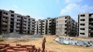
As Mumbai steadily progresses toward becoming a more connected and commuter-friendly city, the Green Line Metro stands as a transformative piece in the city’s transit puzzle. Unlike a singular metro corridor, Mumbai’s Green Line is a collection of multiple connected metro routes—Line 4, Line 4A, Line 10, and the proposed Line 11 (spur line)—that collectively aim to connect the eastern suburbs of Wadala to Mira Bhayandar through Gaimukh and Kasarvadavali.
This extensive corridor is entirely elevated in its current under-construction state, except for the spur line (Line 11), which will feature underground stations. Once complete, the Green Line Metro will enhance accessibility, reduce congestion on Mumbai’s roads, and interlink key junctions with other metro lines, truly becoming a game-changer for residents in both Mumbai and Thane districts.
Also Read:- Mumbai Metro Line 5: Route Map | Stations List | Opening Date | Today Status
What Does the Green Line Metro Consist Of?
The Green Line Metro was split into three major corridors and one spur line for construction ease and planning:
- Line 4: Kasarvadavali to Bhakti Park (Wadala) – Under construction
- Line 4A: Kasarvadavali to Gaimukh – Under construction
- Line 10: Gaimukh to Shivaji Chowk (Mira Road) – Under environmental review
- Line 11: Anik Nagar Bus Depot to SPM Circle – Proposed, soil testing ongoing
What Is the Total Length and Scope of the Green Line Metro?
- Total proposed length: 60.409 km
- Under construction length: 35.2 km
- Main line (Lines 4, 4A, 10): Entirely elevated
- Spur line (Line 11): 16 stations (2 elevated, 14 underground)
- Total stations on main line: 38 (34 currently under construction)
Which Regions Will the Green Line Metro Connect?

The Green Line will stretch from Mira Bhayandar in the north, move through Gaimukh, Kasarvadavali, Thane, Kanjurmarg, Chembur, and eventually reach Wadala, covering:
- Dense residential areas like Mira Road and Thane West
- Transit junctions like Gandhi Nagar (Kanjurmarg) and Siddharth Colony
- Commercial zones like Chembur and Wadala
- Proposed future integration to CSMT via the Aqua Line
Also Read:- Mumbai Metro Line 8: Map | Status | Stations | Connectivity
What Is the Status of Each Corridor in the Green Line Metro?
Line 4: Kasarvadavali to Bhakti Park
- Status: Under construction since October 2018
- Fully elevated
- Passes through Teen Haath Naka, Siddharth Colony, Chembur, Wadala
Line 4A: Kasarvadavali to Gaimukh
- Status: Under construction since September 2019
- Adds northern connectivity for Line 4
Line 10: Gaimukh to Shivaji Chowk (Mira Road)
- Status: Under environmental clearance
- Will push connectivity toward Mira Bhayandar
Line 11: Anik Nagar Bus Depot to SPM Circle
- Status: Soil testing is ongoing
- Spur line with 16 stations, mostly underground
Also Read:- Delhi Metro Blue Line 2025: Station | Route | Maps | Timings
What Are the Interchange Stations Along the Green Line Metro?

Mumbai Metro’s strength lies in its future-ready interchanges. Here are the major confirmed and proposed interchanges:
- Kapurbawdi – Interchange with Orange Line
- Gandhi Nagar (Kanjurmarg) – Interchange with Pink Line
- Siddharth Colony – Interchange with Yellow Line
- Shivaji Chowk (Mira Road) – Proposed interchange with Red Line
- Chhatrapati Shivaji Maharaj Terminus (CSMT) – Proposed interchange with Aqua Line
What Is the Green Line Metro Route and Station Layout?
Although final station names are subject to minor changes, here’s the broad Green Line Metro route:
North-to-South Connectivity:
- Shivaji Chowk (Mira Road)
- Gaimukh
- Kasarvadavali
- Teen Haath Naka
- Kapurbawdi
- Gandhi Nagar (Kanjurmarg)
- Siddharth Colony
- Anik Nagar
- Bhakti Park (Wadala)
- SPM Circle (spur line)
- CSMT (future connection)
This network effectively connects Mumbai’s eastern edge to its suburban north, improving last-mile connectivity and reducing road traffic dependency.
Also Read:- Bangalore Metro Route Map: Timing | Lines | Stations
What’s Unique About the Green Line Metro?
- Longest stretch of elevated metro in the Mumbai Metro system
- Extensive multi-line interchange potential
- Will link northern suburbs to central Mumbai through an uninterrupted elevated corridor
- Focus on dense residential belts, ideal for reducing vehicle usage
- Zero underground stations on the main line (except spur line)
How Will This Metro Line Benefit Mumbai and Thane?

- Major travel time reduction between Mira Road, Thane, and Wadala
- A boost in property value along the metro route
- Encourages sustainable transport choices
- Connects job hubs and residential clusters seamlessly
- Reduces dependency on overburdened Western and Central suburban railway lines
Conclusion
The Green Line Metro is not just a transportation project—it is an ambitious step toward a smarter, faster, and better-connected Mumbai. By connecting the growing suburbs of Mira Bhayandar, Thane, and Chembur to Wadala and creating seamless interchanges with other metro lines, this corridor is poised to reshape how Mumbaikars commute.
With major construction already underway and more phases moving into approvals and soil testing, the Green Line Metro promises to be a lifeline for Eastern Mumbai and Thane in the coming years.
At Housiey, we help you find homes near metro corridors like the Green Line—directly from builders and without sharing your contact information with random brokers.
Planning to explore other lines? Don’t forget to read our blog on the Delhi Metro Blue Line —it’s packed with insights that’ll help you navigate India’s capital like a pro.
FAQs
-
- 60.409 km.
-
- 35.2 km is currently under construction.
-
- Yes, the main line is fully elevated; only Line 11 has underground stations.
-
- 38 stations in total, with 34 under construction.
-
- Line 4A is an extension from Kasarvadavali to Gaimukh.
-
- Line 10 is under environmental review.
-
- A proposed spur line from Anik Nagar to SPM Circle with 16 stations.
-
- 14 underground stations.
-
- Kapurbawdi.
-
- Gandhi Nagar (Kanjurmarg).
-
- Siddharth Colony.
-
- Yes, at Shivaji Chowk (Mira Road).
-
- A proposed extension to CSMT via Aqua Line is planned.
-
- In October 2018.
-
- In September 2019.
-
- Yes, significantly along Eastern Express Highway and the surrounding areas.
-
- Mira Road, Gaimukh, Kasarvadavali, Thane, Chembur, Wadala.
-
- Likely, at major stations, subject to planning.
-
- It’s Mumbai’s longest elevated corridor with multiple interchanges.
-
- Yes, Housiey helps connect you directly with builders in metro-linked zones.
I am Zeeshan Qureshi, a dedicated content writer for Housiey.com, passionate about simplifying the home-buying journey for everyone. With strong expertise in the real estate industry, I strive to offer transparent, reliable, and up-to-date information that empowers homebuyers to make smart property decisions.
My articles, guides, and project reviews reinforce Housiey’s core values—No Brokerage Policy and Bottom Rate Guarantee—ensuring every reader gets genuine market insight, legal clarity, and the most recent trends.
Through Housiey Blogs, I aim to provide readers with valuable knowledge on topics like Real Estate Law, RERA, Stamp Duty, Home Loans, Vastu Tips, and the latest property market updates, blending useful information with a touch of lifestyle, sports, and entertainment content.
Specialization: Project analysis, government policy explainers, financial guidance, home design tips.
Mission: To empower Indian families with trustworthy knowledge for their dream home purchase.
Writing Style: Making complex real estate topics easily understandable and engaging for every reader.
If you are seeking answers to your property questions or want to stay updated with the latest real estate trends, stay connected with Housiey Blogs—where you’ll always find insight, trust, and real-world guidance.
Related Stories