
Check Bhu Naksha Gujarat: Land Record | Village Map
-
By Ayush Oswal
- May 27, 2026
Understanding land records is crucial for property owners, buyers, and real estate professionals. In Gujarat, the digitization of these records has made accessing land information more straightforward than ever. This guide delves deep into Bhu Naksha Gujarat, a pivotal tool for accessing land records and village maps, ensuring you can navigate the system with ease.
Best Investment Properties in Ahmedabad
Explore Top RERA-Approved Projects in Ahmedabad. Buy Directly — No Brokerage!
Explore Ahmedabad Projects →Introduction to Bhu Naksha Gujarat
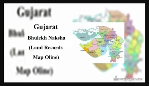
Bhu Naksha Gujarat is a digitized land mapping system that provides cadastral maps, allowing users to view land parcels, boundaries, and ownership details. It is designed to streamline the process of accessing land records and survey numbers across Gujarat’s 33 districts. The platform ensures transparency and efficiency, making it easier for property transactions, dispute resolution, and legal verification.
The Gujarat Revenue Department has integrated land records with GIS-based mapping, providing an interactive village map with survey numbers. This initiative aims to eliminate fraudulent transactions and provide authentic land ownership details to property buyers and government authorities.
Also Read:- Delhi-Dehradun Expressway: Route | Construction | Map | Status 2025
Significance of Village Maps with Survey Numbers
A village map with survey number serves multiple purposes, including:
- Accurate Land Identification: Helps in pinpointing exact land parcels.
- Ownership Verification: Crucial for legal documentation and preventing fraud.
- Agricultural and Developmental Planning: Aids in infrastructure development.
- Dispute Resolution: Acts as a legal record in land-related conflicts.
- Loan Approvals: Required for securing agricultural loans.
Property buyers, developers, and investors can access the Gujarat village map with survey number through the official Bhu Naksha Gujarat online portal, ensuring clarity in land ownership.
India’s First Smart City is Calling You!
India’s #1 Smart City — Top Projects, Direct from Builders — No Brokerage!
Explore GIFT City Projects →Accessing Bhu Naksha Gujarat Online

The Bhu Naksha Gujarat online portal offers a seamless way to retrieve village maps and land details. Here’s how you can access it:
- Visit the official Bhu Naksha Gujarat portal.
- Select the district, taluka, and village from the drop-down menu.
- Enter the survey number or plot number.
- Click on ‘View Map’ to retrieve the land parcel details.
- Download or print the map for reference.
Step-by-Step Guide to Viewing Village Maps

To access the Bhu Naksha Gujarat village map, follow these steps:
- Go to the Official Portal: Visit the Gujarat revenue department’s website.
- Select the Required Details: Choose the district, taluka, and village.
- Enter the Survey Number: Type the land parcel or survey number to fetch details.
- Generate the Map: The system will provide an interactive map with land boundaries.
- Download and Print: If needed, you can save a copy of the map for future reference.
This process makes it easy to retrieve land details, making property transactions more transparent.
Live the Township Life in Shantigram, Ahmedabad!
Luxury township homes with top amenities — Buy Directly — No Brokerage!
Book Your Shantigram Home Now →Understanding the 7/12 Extract and Its Importance

The 7/12 extract (Satbara Utara) is a crucial land record document in Gujarat that contains:
- Survey Number: The unique identifier for land parcels.
- Owner’s Name: The registered name of the landowner.
- Land Use Information: Whether the land is for agriculture, residential, or commercial use.
- Encumbrance Details: Includes any pending loans or disputes.
The 7/12 extract can be accessed via the AnyRoR Gujarat portal, which integrates with Bhu Naksha Gujarat online to provide comprehensive land details.
Also Read:- MHADA to construct 8 lakh houses across the State in 5 years
Integration with AnyRoR Gujarat Portal

The AnyRoR Gujarat (Any Record of Rights) portal is a government initiative to provide digitized land records. This platform:
- Stores land records digitally.
- Provides mutation history and ownership details.
- Allows instant verification of land titles.
By integrating Bhu Naksha Gujarat with AnyRoR, the government has created a one-stop solution for land records and survey maps.
Ahmedabad’s Fastest Growing Locality — Ambli!
Top-rated locality for families & investors alike — RERA Approved — No Brokerage!
Unlock Ambli’s Top Projects →Role of E-Dhara Kendra in Land Record Management
E-Dhara Kendras are established at taluka-level offices across Gujarat to digitize and store land records. These centers provide:
- Certified land record copies.
- Mutation entry for property transactions.
- Correction of land record discrepancies.
Users can also verify their Gujarat village map with survey number through E-Dhara Kendras if they face any issues with the online portal.
Also Read:- Patna Airport | Name | Pin Code – Terminal Information | 2025
Bhu Naksha Gujarat Portal Features
The Bhu Naksha Gujarat portal provides:
- Village-wise cadastral maps.
- Real-time land ownership data.
- Survey number-based map retrieval.
- Land classification details (agricultural, commercial, residential).
These features make it easy for citizens, developers, and officials to track land ownership records.
Also Read:- AP Stamp Duty and Registration Charges in 2025 – Housiey
Bhu Naksha Gujarat Online Login Process
To access personalized features, users can log in to the Bhu Naksha Gujarat portal by following these steps:
- Visit the login page of the official portal.
- Enter the credentials provided by the Gujarat Revenue Department.
- Access the land records linked to the registered account.
Government officials, surveyors, and landowners can use this Bhu Naksha Gujarat online login to manage land records efficiently.
Accessing Maps for Specific Regions: Bhu Naksha Gujarat Kutch
The Bhu Naksha Gujarat Kutch maps are vital due to Kutch’s vast land area. Many investors and developers require precise land records in Kutch for:
- Industrial expansion projects.
- Agricultural land purchases.
- Dispute resolution over land boundaries.
Kutch’s unique topography makes accurate land records essential for legal and commercial purposes.
Smart Investors Always Choose Thaltej!
Ahmedabad’s most connected & premium address — Top Projects — No Brokerage!
Browse Thaltej’s Best Properties →Benefits of Using Bhu Naksha Gujarat
- Transparency in land ownership.
- Quick access to digitized maps.
- Reduction in property fraud cases.
- Time-saving compared to manual record retrieval.
By using My Estate Point village map with survey numbers, users can cross-check land ownership before making investment decisions.
Challenges and Solutions in Accessing Land Records
Challenges:
- Technical issues on the portal.
- Incorrect survey number entries.
- Delays in land record updates.
Solutions:
- Using alternative portals like AnyRoR.
- Visiting E-Dhara Kendras for verification.
- Contacting the Gujarat Revenue Department for assistance.
Also Read:- Gold vs Real Estate | Best Investment Comparison in India in 2025
Future Prospects: Bhu Naksha Gujarat 2025 and Beyond
By 2025, Bhu Naksha Gujarat aims to integrate AI-driven mapping for:
- Automated dispute resolution.
- Real-time land use tracking.
- Blockchain-based land ownership verification.
This advancement will further enhance land transparency and security.
Conclusion
Bhu Naksha Gujarat is an essential tool for property verification, investment decisions, and land dispute resolution. By providing an easy-to-use village map with survey number, it ensures transparency in Gujarat’s land ownership system. Whether you are a buyer, seller, or government official, this platform simplifies land record management.
If you’re interested in real estate regulations, don’t forget to check out our detailed blog on RERA Karnataka for insights into Karnataka’s property laws.
- It is an online platform providing digitized village maps and land records.
- Visit the Bhu Naksha Gujarat portal and enter your district, taluka, and survey number.
- Yes, it is a government-provided service that is free for public use.
- Yes, once you enter the details, you can download and print the map.
- You need the district, taluka, village name, and survey number of the land.
- Visit the nearest E-Dhara Kendra or contact the Gujarat Revenue Department.
- Yes, you can search for land details using the Bhu Naksha Gujarat Kutch section.
- Bhu Naksha Gujarat provides cadastral maps, while AnyRoR gives ownership details and land records.
- No, basic land records can be accessed without logging in. However, officials need to log in for advanced features.
- No, for ownership details, you need to visit the AnyRoR Gujarat portal.
- Yes, it helps verify land location, boundaries, and legal records before purchasing.
- Updates depend on government records; it’s advisable to verify details at E-Dhara Kendras.
- Yes, the website is mobile-friendly, and some services are available through government apps.
- Check the AnyRoR Gujarat portal or visit the local Revenue Office.
- Yes, the map indicates government-owned and private land parcels.
- It provides legal land records that can support dispute resolution in courts.
- Only government officials have login credentials; general users can access maps without logging in.
- The government plans to integrate AI-based mapping and blockchain for secure land transactions.
- No, for land use conversion, visit the Gujarat Revenue Department’s website.
- Yes, the portal covers all 33 districts and their respective villages.
Ayush Oswal is an SEO Executive at Housiey, specializing in optimizing real estate content for better visibility and engagement. With a strong understanding of SEO strategies and the property market, he ensures that every blog helps homebuyers make informed decisions while performing well on search engines.
Related Stories