Mumbai Metro Line 3 Map: Route Map | Opening Date | Latest News
-
 By L. Sadriwala
- November 19, 2025
Introduction: Why Is Mumbai Metro Line 3 One of the Most Transformational Projects in the City?
Mumbai grows vertically, horizontally, and in sheer intensity every single year. With rising population, shrinking road space, and increasing pressure on suburban railways, the need for a high-capacity, fast, and dependable transport system has never been greater. This is exactly where Mumbai Metro Line 3, also called the Aqua Line Metro Mumbai, becomes a turning point for the city.
This fully underground corridor connects South Mumbai to the Western suburbs, cutting travel times drastically while reducing traffic congestion across some of the city’s most saturated routes. With 27 stations across two phases, the Mumbai Metro Line 3 map marks the beginning of a new era for urban mobility in India’s financial capital.
In this blog, we explore every significant detail—the Mumbai Metro Line 3 route map, station list, start date, updates, completion timeline, operations, ticketing system, latest news, and everything else that matters. Each aspect is broken down systematically to give you the most comprehensive and readable analysis.
Also Read:- Mumbai Metro Line 5: Route Map | Stations List | Opening Date | Today Status
What Is the Complete Mumbai Metro Line 3 Route Map?
The Mumbai Metro Line 3 route map spans 33.5 km, running from Colaba to SEEPZ and covering some of the most critical residential, commercial, and employment hubs in Mumbai. As an entirely underground metro corridor, it eliminates issues of land acquisition, reduces environmental impact on surface-level urban areas, and ensures seamless connectivity through congested zones.
Key Highlights of the Mumbai Metro Line 3 Map:
- Total length: 33.5 km
- Total stations: 27
- Type: Fully underground
- Corridor name: Aqua Line Metro Mumbai
- Connectivity: South Mumbai, Central Mumbai, Western suburbs, and key financial/tech hubs
- Interchanges: With existing and upcoming Mumbai metro map corridors
This line will significantly ease pressure on the Western Railway local lines and the arterial road network.
Also Read:- Mumbai Metro Line 8: Map | Status | Stations | Connectivity
Which Stations Are Covered Under the Metro Line 3 Stations List?
The metro line 3 stations cover a wide range of zones. For clarity, here is the systematic, phase-wise list:
Phase 1 Stations (Aarey to BKC):
- Aarey
- SEEPZ
- MIDC
- Marol Naka
- Sahar Road
- CSMIA Terminal 2
- Santacruz
- Bandra-Kurla Complex (BKC)
Phase 2 Stations (BKC to Colaba):
- Dharavi
- Shitladevi
- Dadar
- Siddhivinayak
- Mahim
- Worli
- Haji Ali
- Mahalaxmi
- Mumbai Central
- Byculla
- Girgaon
- Kalbadevi
- CST
- Churchgate
- Vidhan Bhavan
- Hutatma Chowk
- Navy Nagar
- Cuffe Parade
- Colaba
This expansive list ensures that areas currently underserved by high-speed transport gain smooth, reliable metro access.
Also Read:- Pros and Cons of Buying a Property Near Mumbai Metro Lines
How Does the Line 3 Mumbai Metro Map Improve Daily Travel?

The line 3 Mumbai metro map is built to solve some of Mumbai’s biggest transit problems:
Major Benefits:
- High-capacity trains reduce crowding on suburban local networks.
- Underground alignment significantly lowers traffic disruptions.
- Direct connectivity from Colaba to business hubs like BKC and SEEPZ.
- Faster access to airports via Sahar Road and T2 stations.
- Enhanced connectivity for South Mumbai, which has long lacked metro access.
Even more importantly, it brings uniform connectivity across residential and commercial clusters.
What Is the Mumbai Metro Line 3 Opening Date?
The Mumbai Metro Line 3 opening date is planned in two phases. Due to technical complexity and tunneling challenges, the timeline has seen multiple extensions. However, the project is now in its final construction stage.
What Is the Metro Line 3 Completion Date for Phase 1 and Phase 2?
Phase 1: Aarey to BKC
Scheduled completion: Coming up soon, with civil work and system installations nearing closure.
Phase 2: BKC to Colaba
The metro line 3 completion date for Phase 2 is expected shortly after Phase 1, with testing, certifications, and trials ongoing.
What Is the Mumbai Metro Line 3 Start Date for Operations?
The Mumbai Metro Line 3 start date will be announced officially once safety clearances and trial runs are fully completed. Phase 1 is likely to open first, followed by Phase 2.
What Is the Latest Mumbai Metro Line 3 Update?
Here is the latest progress overview:
- Track laying and electrical integration are in advanced stages.
- Trial runs for Phase 1 have already commenced on certain stretches.
- Aarey metro station line 3 construction is now structurally complete.
- Tunneling for the entire route has been completed.
- Station interiors, concourses, escalators, and platform screen doors are being installed.
The project is moving toward the final approval stage.
What Is the Mumbai Metro Line 3 Phase 2 Opening Date?
The Mumbai Metro Line 3 phase 2 opening date depends on completion, testing, and system integration. After Phase 1 begins operations, Phase 2 is set to follow soon.
How Will the Aarey Metro Station Line 3 Impact Western Suburb Connectivity?

The Aarey metro station line 3 serves as the depot zone and the northern terminal. It plays an important role because:
- It connects the Western suburbs to major hubs like BKC, Mahalaxmi, Mumbai Central, and Colaba.
- It provides interchange flexibility with other metro routes on the future Mumbai metro map.
- It supports seamless commuting for office workers in SEEPZ, MIDC, and Marol.
This station is one of the busiest expected points on the corridor.
How Will Mumbai Metro Line 3 Improve Airport Connectivity?

This corridor offers direct airport access through:
- Sahar Road station
- CSMIA Terminal 2 station
It cuts travel time drastically, making airport reach easier for residents across South and Central Mumbai.
What Are the Expected Mumbai Metro Line 3 Timings?
Once operations start, expected Mumbai Metro Line 3 timings will be:
- 5:30 AM to 11:30 PM
- Peak-time frequency: Every 4–5 minutes
- Off-peak: Every 7–8 minutes
These timings align with most other metro corridors.
Will Mumbai Metro Line 3 Have Online Tickets?
Yes, the metro will support:
- Mumbai Metro Line 3 online tickets
- Mobile QR tickets
- Smart cards
- Digital passes
- Integrations with metro apps
This ensures a cashless, frictionless experience.
Why Is the Mumbai Metro Map Line 3 Important for South Mumbai?

South Mumbai is dense, high-traffic, and heavily dependent on roads and local trains. The Mumbai metro map line 3 connects:
- Cuffe Parade
- Colaba
- Nariman Point
- Churchgate
- CST
- Haji Ali
- Mahalaxmi
- Worli
For the first time, these zones get metro access—creating a balanced public transport network across the city.
How Does Metro Line 3 Fit Into the Larger Mumbai Metro Map?

The Aqua Line links with:
- Line 1 (Versova–Ghatkopar)
- Line 2A & 2B (Dahisar to DN Nagar to Mandale)
- Line 7 (Dahisar East to Andheri East)
- Line 4 and 4A
- Line 6 (Jogeshwari–Kanjurmarg)
This expands city-wide connectivity and reduces travel dependency on private vehicles.
Conclusion: How Will Mumbai Metro Line 3 Transform Mumbai’s Future Transport Landscape?
The completion of Mumbai Metro Line 3 marks a monumental leap for the city’s infrastructure. It enhances mobility across South, Central, and Western Mumbai while supporting faster commutes, reduced congestion, smoother airport access, and stronger connectivity across key employment districts. As a high-capacity underground corridor, it stands as one of India’s most ambitious metro projects to date.
For homebuyers, renters, and investors, the areas around Aarey, BKC, Worli, Mahalaxmi, Mumbai Central, and Colaba are set to appreciate due to improved travel convenience. This opens new residential and commercial opportunities across the city.
At Housiey, we guide buyers with verified project insights, clarity, and complete transparency, helping them make confident decisions in a rapidly transforming Mumbai.
If you want to understand how another major metro line will reshape connectivity, make sure to read our in-depth blog on Mumbai Yellow Line Metro.
FAQs
- It is approximately 33.5 km long.
- The entire route is constructed as an underground corridor.
- There are 27 stations on the route.
- They are divided into Phase 1 and Phase 2 sections.
- Yes, it is the city’s first fully underground metro corridor.
- This helps avoid land acquisition and reduces road-level disruption.
- The start date will be officially announced after safety approvals.
- Phase 1 will begin operations before Phase 2.
- It starts at Colaba and ends at Aarey.
- The route connects South Mumbai to the Western suburbs.
- Aarey serves as the terminal station and depot location.
- It enhances Western suburb connectivity with BKC and South Mumbai.
- Phase 1 completion is nearing final testing stages.
- Phase 2 will follow once installations and certifications conclude.
- Yes, via Sahar Road and T2 stations.
- This will reduce airport travel times significantly.
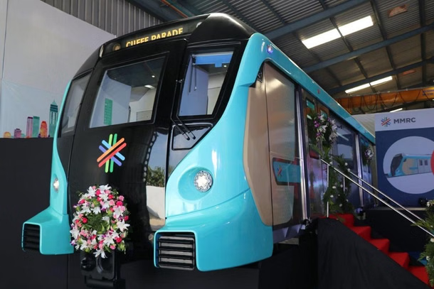
- High-capacity, modern underground metro trains.
- They will include advanced safety and signalling systems.
- Yes, digital QR codes and smart cards will be available.
- Online payment systems will be integrated with metro apps.
- Tentatively between 5:30 AM and 11:30 PM.
- Frequency is expected to be 4–8 minutes depending on peak hours.
- Colaba, CST, Worli, BKC, MIDC, and Aarey.
- These zones will experience faster, smoother travel.
- It covers the stretch from BKC to Colaba.
- This phase has several landmark stations in South Mumbai.
- Yes, significantly on routes like Haji Ali, Worli, and Mumbai Central.
- Underground travel reduces pressure on surface roads.
- Complex tunnelling and densely built urban environments.
- Multiple heritage and utility sensitivities affected timelines.
- Yes, at BKC, Mumbai Central, and other key nodes.
- These ensure seamless travel across the wider Mumbai metro map.
- It is another name for Mumbai Metro Line 3.
- The corridor has been designated with the aqua colour code.
- Yes, areas near stations often see price appreciation.
- Better connectivity increases rental demand too.
- Estimated travel time is around 40 minutes.
- This is significantly faster than road-based travel.
- Yes, with elevators, ramps, and tactile flooring.
- Stations are designed to meet universal accessibility standards.
L. Sadriwala, the Editor-in-Chief at Housiey, is a seasoned writer whose professional journey in content creation began in 2015. With a background rooted in a family of real estate developers, her transition into real estate writing was a natural evolution, bringing together her storytelling expertise and deep industry understanding.
Over the years, she has authored impactful blogs across diverse niches such as food, travel, and lifestyle, before establishing her reputation as a trusted voice in Indian real estate. Today, her work stands out for its clarity, accuracy, and ability to simplify complex property concepts for readers.
At Housiey, every article crafted by L. Sadriwala reflects thorough research, verified facts, and a reader-first approach. From decoding housing policies and trends to offering in-depth builder reviews and project insights, her mission is clear: to empower homebuyers and investors with the knowledge they need to make confident property decisions.
Her writing not only informs but also builds trust, making her one of the most credible editorial voices in the real estate space.
Related Stories