Regional ring road Hyderabad: Road Map | Village List | Route | News
-
 By L. Sadriwala
- August 12, 2025
Hyderabad has been one of India’s fastest-growing cities for over a decade, and its booming IT sector, thriving real estate market, and expanding industrial corridors have pushed the city’s infrastructure to its limits. The upcoming Regional Ring Road Hyderabad project promises to be a game-changer — a massive outer beltway designed to connect peripheral towns, boost connectivity, and open up new zones for development. More than just a highway, this project is about redefining how people, goods, and businesses move around Telangana’s capital. From the regional ring road map and alignment details to the regional ring road villages list, this blog covers every detail you need to know — along with the regional ring road latest news and updates shaping its progress.
Also Read:- How to Check and Pay Property Tax in Hyderabad in 2025
Why is the Regional Ring Road Hyderabad being developed?
The core city is already served by the Outer Ring Road (ORR), but traffic demands and development patterns have now shifted outward. The Hyderabad Regional Ring Road will sit even further out, creating a new mobility belt that links rural and semi-urban areas directly to national highways. Its aim is threefold:
- To divert heavy vehicles away from congested city roads.
- To connect emerging industrial hubs and logistics parks.
- To stimulate growth in surrounding districts without overwhelming the city core.
By understanding the regional ring road details, it’s clear this is a forward-looking plan — designed not just for today’s needs but for the next 20–30 years of Hyderabad’s expansion.
Also Read:- Top Builders and Developers in Hyderabad: A Comprehensive Guide
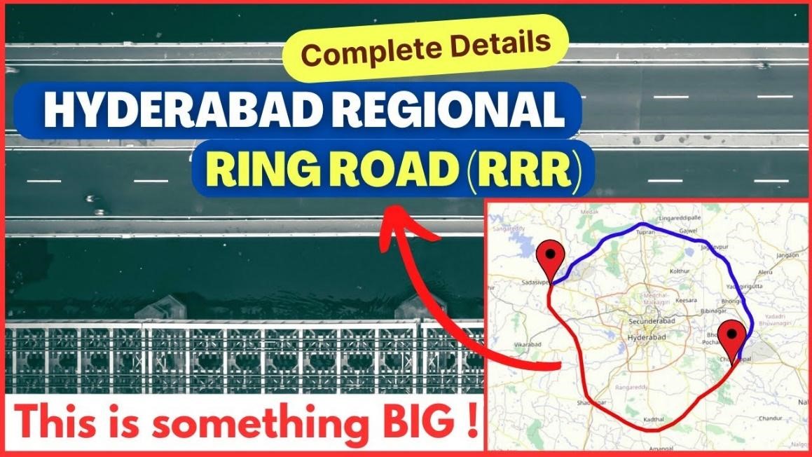
What does the Regional Ring Road Route Map look like?

The regional ring road route map shows a massive circular alignment spanning several districts. It is designed to connect with key national highways such as NH-44, NH-65, and NH-163. The alignment covers:
- Northern stretches linking Sangareddy and Yadadri-Bhongir.
- Eastern segments passing through Bhongir and Choutuppal.
- Southern arcs touching Amangal and Shadnagar.
- Western stretches covering Chevella and Vikarabad.
This design ensures that vehicles traveling between different parts of Telangana and neighboring states can bypass Hyderabad entirely, cutting travel time and fuel costs significantly.
Also Read:- Farmhouse vs Plot: Which is a Better Investment for the Future?
Which villages are in the Regional Ring Road Villages List?

One of the most crucial aspects is the regional ring road villages list, as it determines which areas will be directly impacted by the project. The alignment passes through multiple mandals and dozens of villages, including:
- In Sangareddy district: Kandi, Sadashivpet, and Nandigama.
- In Ranga Reddy district: Chevella, Moinabad, and Shadnagar surroundings.
- In Yadadri-Bhongir district: Mothkur, Raigiri, and Wangapalli.
- In Vikarabad district: Dharur, Pudur, and Tandur outskirts.
For landowners in these areas, knowing their survey numbers and alignment details is essential, as these form the basis for compensation and relocation planning.
What are the Regional Ring Road Details?

The regional ring road details reveal the scale and ambition of the project:
- Total Length: Around 340 km (split into northern and southern sections).
- Right of Way: 100 meters wide to allow for future expansion.
- Design: 8–10 lanes including service roads, median strips, and green buffers.
- Infrastructure: Multiple interchanges, toll plazas, bridges, and drainage systems.
- Budget: Estimated in thousands of crores, with phased construction planned over several years.
These specifications show that the Hyderabad Regional Ring Road is not just another bypass — it’s a high-capacity expressway built for long-term heavy-duty traffic.
Also Read:- Real Estate Tokenization: Benefits, Risks, and How It Works
How does the Regional Ring Road Map with Survey Numbers help landowners?
A regional ring road map with survey numbers is a cadastral overlay that pinpoints exactly which plots fall within the acquisition area. It’s crucial because:
- Landowners can verify their land’s status and prepare legal documents.
- Authorities can maintain transparency in compensation processes.
- Any disputes over land boundaries can be resolved before construction begins.
This level of clarity prevents surprises and allows affected families to plan their next steps.
What’s the Regional Ring Road Latest News?
Recent regional ring road latest news indicates:
- Land acquisition processes are well underway in both northern and southern segments.
- Detailed project reports have been finalized for several stretches.
- The state government is pushing for central assistance to speed up construction.
- Some stretches may be taken up on a public–private partnership (PPP) model for faster execution.
The expectation is that construction will begin in phases, with some stretches potentially operational before the entire loop is completed.
How will the Regional Ring Road Telangana transform the state’s economy?
The regional ring road Telangana project will have far-reaching economic impacts:
- Industrial Growth: It will directly connect several industrial parks, SEZs, and logistic hubs to national highways.
- Real Estate Development: Land near the alignment is already witnessing a surge in interest from developers.
- Tourism Boost: Improved connectivity to rural and heritage destinations will promote tourism.
- Job Creation: From construction work to long-term logistics employment, the ripple effects will be substantial.
Much like the ORR did for Hyderabad’s IT corridor, the Regional Ring Road will open entirely new growth corridors.
What does this mean for Hyderabad’s future?
The Hyderabad Regional Ring Road is more than just a transport project — it’s a structural shift in how the city and its surroundings will function. By pushing growth outward, it will balance urban density, make commutes more efficient, and create opportunities in places that were once considered too remote. If implemented efficiently, it will be a backbone for Telangana’s economic strategy for decades to come.
Conclusion
The Regional Ring Road Hyderabad is one of the most ambitious infrastructure projects in Telangana’s history. By studying the regional ring road map, the regional ring road villages list, and the regional ring road route map, it becomes clear that this project will reshape connectivity, decentralize growth, and bring remote areas closer to economic activity. With its scale, planning, and strategic importance, it’s set to become a milestone in Hyderabad’s transformation story.
At Housiey, we bring you the latest real estate and infrastructure insights that matter. If you found this deep dive helpful, don’t miss our detailed blog on the Delhi Mumbai EXPRESSWAY, another game-changing project that’s rewriting India’s connectivity map.
FAQs
- It’s meant to divert heavy traffic from the city’s core and improve connectivity across Telangana.
- It also aims to encourage industrial, residential, and commercial growth in peripheral regions.
- The planned width is around 100 meters, accommodating 8–10 lanes and service roads.
- This width allows for future expansion if traffic demands increase.
- Land acquisition and surveys are currently in progress for several segments.
- Physical construction is expected to start soon in a phased manner.
- Dozens of villages across Sangareddy, Ranga Reddy, Yadadri-Bhongir, and Vikarabad districts are included.
- These are listed in the official regional ring road villages list.
- Survey numbers identify specific plots in government land records.
- They help determine which parcels are affected by acquisition.
- Yes, the project includes tree transplantation, green buffers, and waterway protection.
- Sensitive zones will have special engineering solutions like viaducts.
- Funding will be a mix of state budget, central assistance, and PPP models.
- Some stretches may also be financed through infrastructure bonds.
- Toll plazas are planned at major interchanges for revenue generation.
- Details of toll rates will be announced closer to opening.
- Better road access will connect villages to markets, schools, and hospitals.
- Job opportunities will also increase in logistics and allied industries.
- Yes, they can file objections during public hearings.
- All grievances are reviewed before finalizing acquisition.
- It’s a detailed cadastral map showing affected plots along the route.
- It ensures transparency and accuracy in compensation.
- Hyderabad’s RRR is planned to be wider and more future-proof.
- It also covers a larger peri-urban area for development.
- Yes, feeder roads will connect smaller villages to the main corridor.
- This ensures no community is left isolated.
- Preliminary maps are already available in planning documents.
- Final maps with survey details are released during acquisition notices.
- The first phases aim for completion by 2027–2028.
- Remaining stretches will follow based on progress and funding.
- Indian Roads Congress (IRC) standards for high-capacity highways.
- Pavement quality is designed for heavy commercial traffic.
- Yes, rest areas and fuel stations will be built at regular intervals.
- Emergency response facilities will also be included.
- Telangana’s Roads & Buildings Department is leading it.
- Central agencies may assist in certain aspects.
- There’s potential for bus rapid transit integration in the future.
- This would make intercity travel more efficient.
- Follow announcements from the state transport department.
- Local district offices also post regional ring road latest news.
L. Sadriwala, the Editor-in-Chief at Housiey, is a seasoned writer whose professional journey in content creation began in 2015. With a background rooted in a family of real estate developers, her transition into real estate writing was a natural evolution, bringing together her storytelling expertise and deep industry understanding.
Over the years, she has authored impactful blogs across diverse niches such as food, travel, and lifestyle, before establishing her reputation as a trusted voice in Indian real estate. Today, her work stands out for its clarity, accuracy, and ability to simplify complex property concepts for readers.
At Housiey, every article crafted by L. Sadriwala reflects thorough research, verified facts, and a reader-first approach. From decoding housing policies and trends to offering in-depth builder reviews and project insights, her mission is clear: to empower homebuyers and investors with the knowledge they need to make confident property decisions.
Her writing not only informs but also builds trust, making her one of the most credible editorial voices in the real estate space.
Related Stories